A view from LeVeaux Mountain looking north into the fog above the sugar maple forest.
LeVeaux Mountain is a part of the Sawtooth Mountains in northeastern Minnesota and located in Cook County. It rises about 1,586 feet above sea level and 986 feet above Lake Superior. On its south side it overlooks Lake Superior. On LeVeaux Mountain’s north are spectacular views of a forest including a stand of ancient sugar maple. To the east is the Onion River named after all the wild leeks that grow in the sugar maple forests. To the west are miles of thick forest and swamps.
Part of the Superior Hiking Trail spur loop on LeVeaux Mountain.
A section of the Superior Hiking Trail goes by LeVeaux Mountain with a small spur loop on the west side that makes accessing the mountain possible. Most of the land that includes the mountain is part of the Superior National Forest and so anyone can walk off the trail without violating private property laws. However, the terrain is rugged and steep cliffs and talus slopes ring much of the mountain making casual hiking dangerous. I don’t recommend it for people unfamiliar with hiking in roadless or trail-less places. You could get seriously hurt.
Loose rocks, trees, and soil slowly slide down the north face of LeVeaux Mountain.
I’ve hiked off trail on and around LeVeaux Mountain several times but I’ve gone prepared (including studying maps and aerial photos well beforehand) and dressed in suitable clothing not the shorts, t-shirts, and sneakers I often see on some day hikers using the trail. Such treks have been rewarding and physically challenging but that’s what I was seeking.
The Onion River which flows along the eastern side of LeVeaux Mountain.
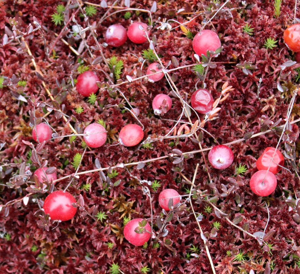
Just the thought of these tart red berries makes my mouth water. These are fruits of small cranberry (Vacciniumoxycoccos) and not to be confused with the ones in the grocery stores, which are cultivars of large cranberry (Vaccinium macrocarpon). Both species grow in wet habitats with deep peat soils. Vaccinium macrocarpon is only native to North America, but Vacciniumoxycoccos has a circumboreal distribution. Outside of North America, Vacciniumoxycoccos is cultivated to some extent.
I’ve found small cranberry in intermediate fens, poor fens, and raised bogs. They seem to fruit best in full sun. Sometimes they will make a few berries under the shade of tamaracks and black spruce. This group is growing in an open poor fen with lots of peat moss and cottongrass and no trees. There were thousands of berries to pick, but they were a little past their prime after a recent hard frost. I don’t know what wild animals and birds might feed on them. Perhaps ruffed grouse or bears do. I saw bear tracks in the fen and ruffed grouse along its edge in the low-growing shrubs, but no sign that the berries had been eaten.
Speyeria atlantis and Polites mystic found on the Forest Road 102
On one of the days during my vacation last July I headed for Finland, Minnesota to follow the Heffelfinger Road. This would connect me with Cloquet Lake Road and from there to a little lake named Drake Lake. But as I left Finland there was a sign that said the road was closed ahead due to bridge reconstruction. I continued on a bit and saw the bridge was definitely not there anymore.
The day was still young so, I turned around and headed to Highway 11 where I knew of another way to get to Drake Lake albeit more difficult. This was the Beaver River Road and by following it north I would be able to connect to Heffelfinger Road and avoid construction. After a few miles, a sign appeared saying “road closed ahead”. Apparently another bridge was being repaired. But there was still one more way to get to Drake Lake.
This alternate route was Forest Road 102 which would connect me with Camp 26 Road where Drake lake was located. Forest Road 102 was a rough ride with many deep puddles straddling the road, ruts, and large rocks. I think my average speed was about 5 mph.
Finally, I got to Camp 26 Road. Nothing looked familiar. So much had changed since I was last there in 1995 including Forest Road 102 which was more like a two-rut road back then. Much of the forest had been cut down in the intervening years and there are now many gated driveways to hunting cabins. I never did find Drake Lake that day although I probably drove right by it. You can’t see it from the road as it is hidden by about 500 feet of dense forest.
Drake Lake is one of many small lakes in northern Minnesota gradually turning into a peatland, a centuries-long process. The water is dark brown like strong coffee from tannic acids leaching from deposits of peat. Surrounding Drake Lake is a floating fen thick with sphagnum and stunted leatherleaf shrubs. On the north side of the lake is a white cedar forest.
Patches of pogonia, clubspur, and dragonhead orchids, beaked rushes, yellow-eyed grass, and bladderwort plants grow on the floating peat mat. When in bloom these decorate the floating mat with masses of pink, white, yellow, and rusty brown flowers. I’ll be back there next year and hopefully, the bridges will be repaired by then. If not I’ll take Forest Road 102 again.
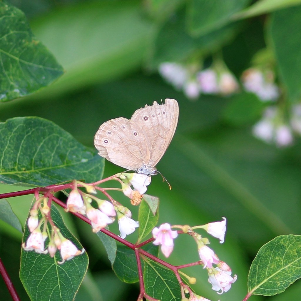
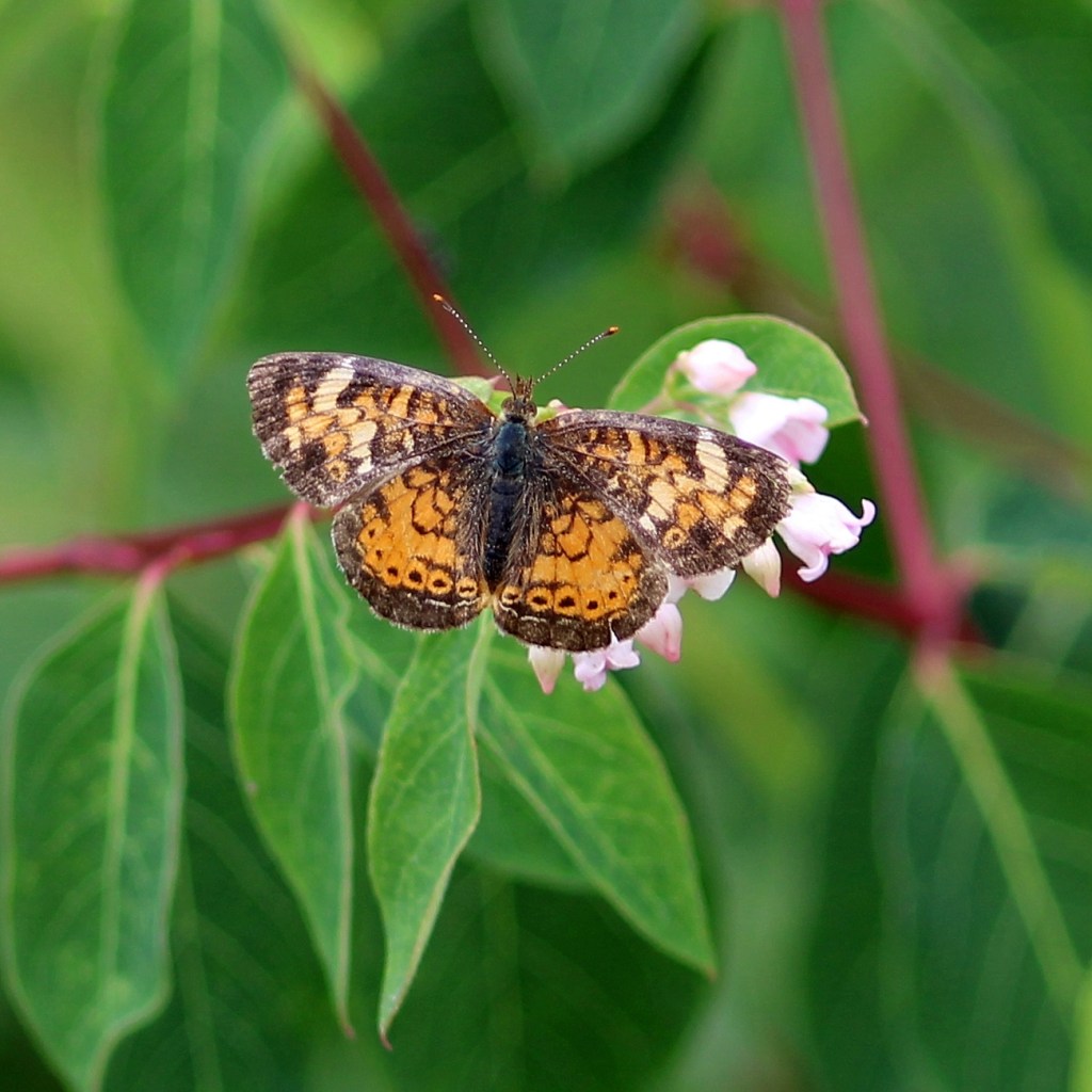
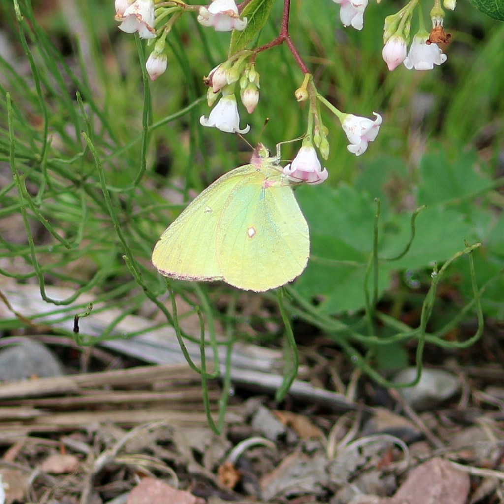
I did find other interesting spots along the road. One of these was a long patch of spreading dogbane with dozens of butterflies nectaring on the sweet flowers. So I spent some time there trying out a new camera lens. Above and below are a few of the species I was able to identify.
Satyrodes eurydicePolites mysticPhyciodes tharosColias interiorBoloria seleneButterflies from Forest Road 102
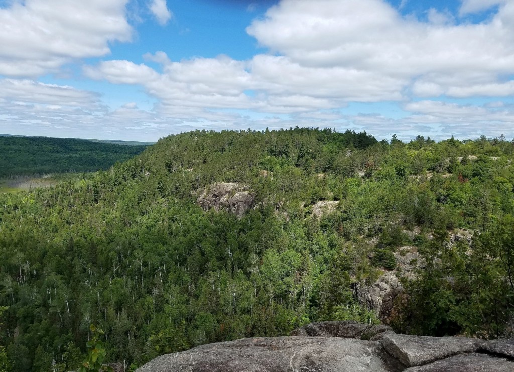
A view of a mountain from the mountain on a section of the Superior Hiking Trail located north of Little Marias, Minnesota. I’d really like to get to that other mountain sometime. It looks interesting.
Or maybe a mountain. Hard to say but there was at least one point where the elevation above the surrounding terrain was just a little bit above 1,000 feet or 1,613 feet above sea level and so 1,010 feet above Lake Superior if Google Earth is to be believed. I don’t even know if this hill or mountain is named. I’m sure that somewhere it is on a map with a name. This mountain is on a part of the Superior Hiking Trail, a 310-mile long trail that stretches from the Minnesota-Wisconsin border southwest of Duluth to the US-Canada border in northern Minnesota. This trail section is known as Section 13.
I’d been planning this day hike for several weeks intending to get to that other mountain in the above photo. Google Earth showed a spur from the main trail going to it. So early one morning in July I parked my vehicle in the trailhead lot and began my ascent. I got as far as the top of the mountain that day but turned back since my plans were only to do a little reconnaissance and get a feel for what this place was like. The next day I came back and continued past my first stop.
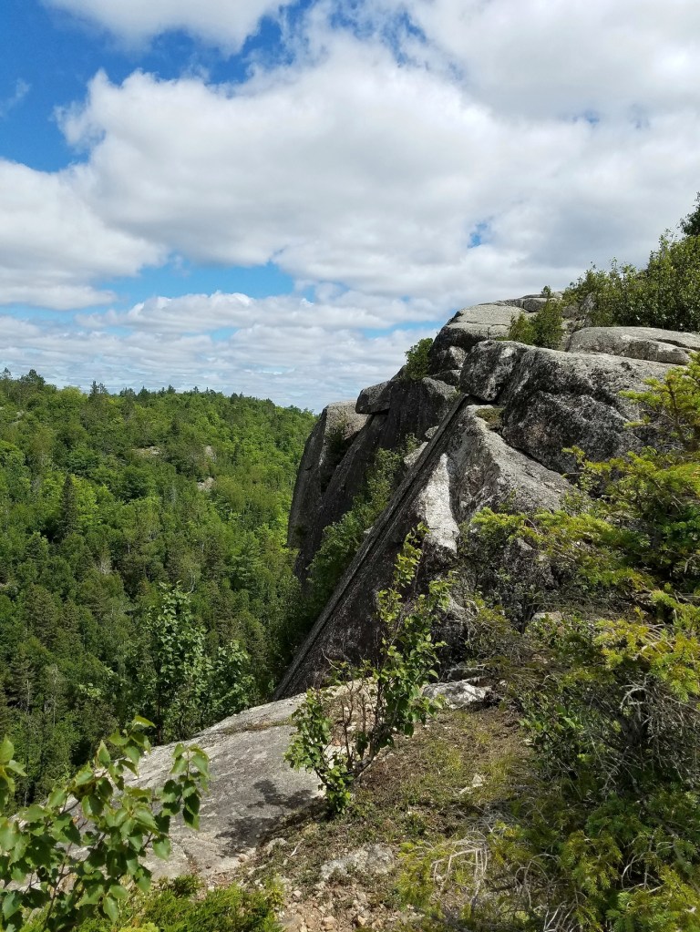
This is where I made my first stop. It’s a long way down. The rocks are almost entirely anorthosite which is a very hard plagioclase feldspar. The hardness of this rock resisted glacial scouring better than the relatively softer rocks overlaying it resulting in a series of peaks known as the Sawtooth Mountains because of their sharp profiles.
The climb is very steep in most places but doable in ordinary hiking boots. I got to where I made my first stop the day before and took a short break for some lunch and water. Then I continued on towards Camp 13 and then beyond it to where the trail descended into a deep gorge. According to the map near the bottom of the trail in the gorge is a spur that loops around the other mountain. Well, I looked for it as I hiked along the trail but never saw it. Maybe the map is wrong? I think so. The rest of the trail followed pretty much where the map said it would. When it opened up onto an expansive marsh crossed by a rickety footbridge I figured it was time to turn back. Besides, I had homemade pizza and some cold IPA back at the national forest campsite where I was staying and felt I could really use those. And there was that sci-fi book I was working my way through, too.
So, I didn’t get to the other mountain that day. I’ll give it try next year. In any event, I had an interesting and pleasant two days time trekking up and down the hill (or is it a mountain?), saw fantastic scenery, and found some interesting insect and plant life, too.
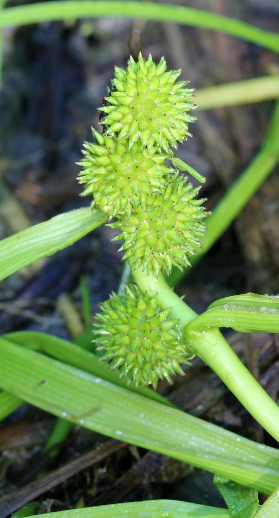
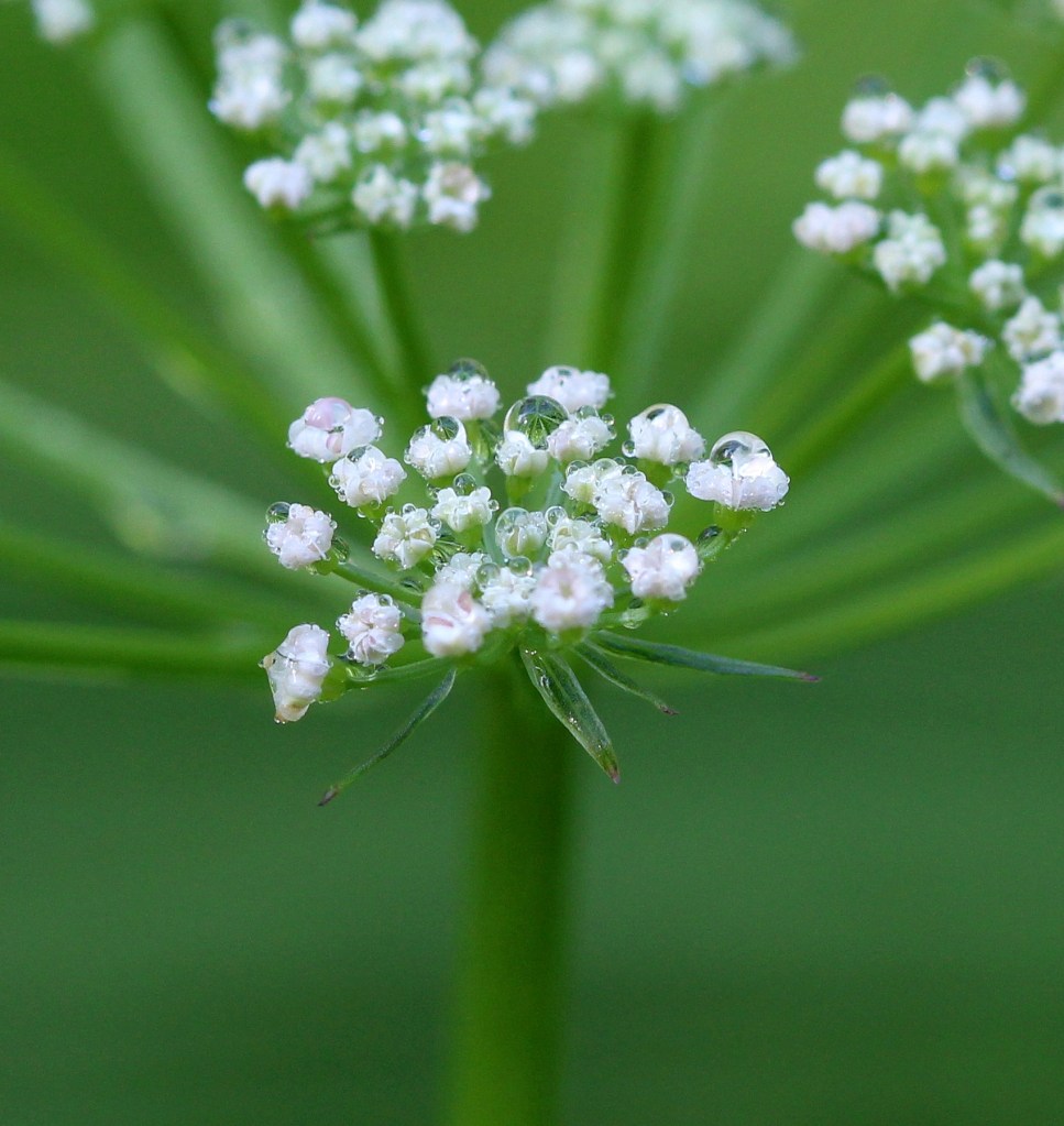
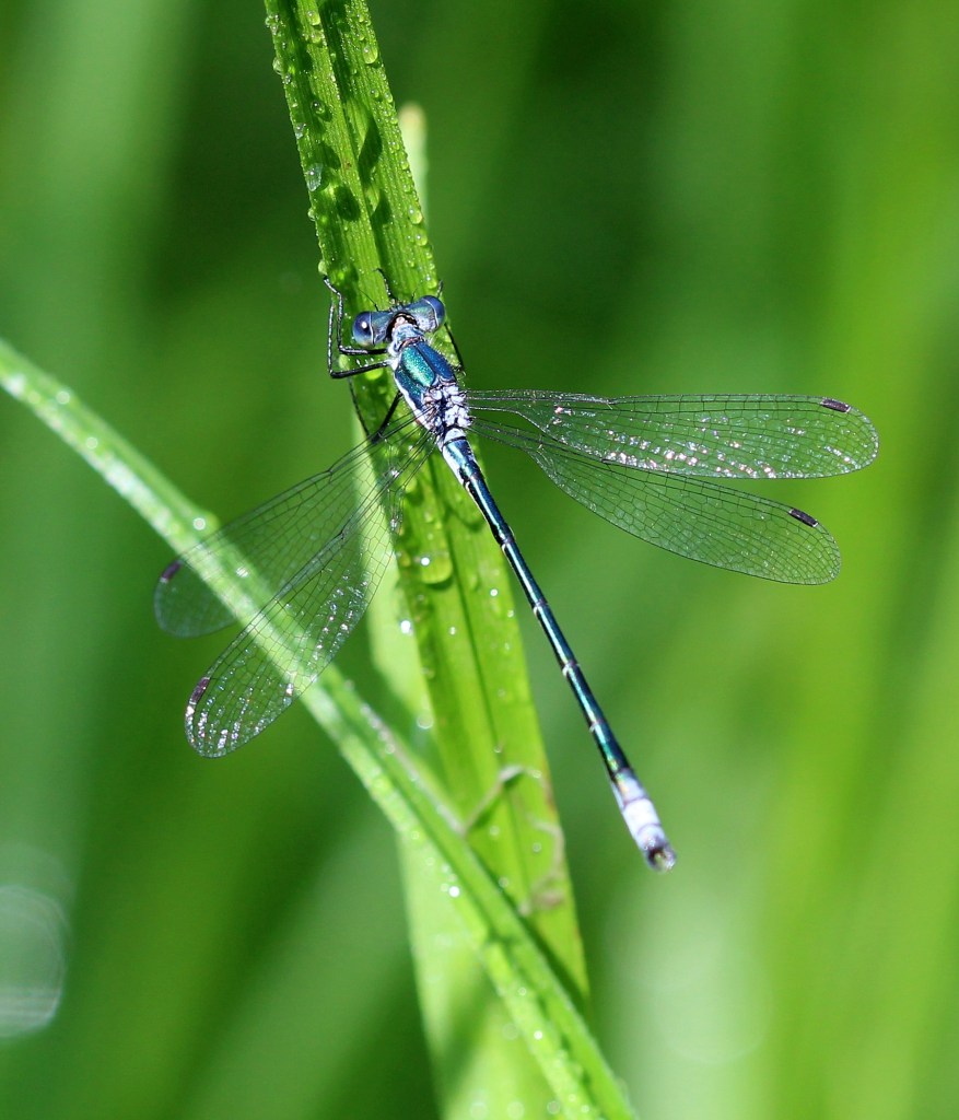
Clustered bur-reedSium suave flowers and dewLestes disjunctus, a damselfly
Above are few examples of plants and insects found in a small marshy woodland vernal pool just off the trail. The clustered bur-reed (Sparganium glomeratum) is an odd bur-reed that often grows in woodland vernal pools rather than lakeshores and rivers.
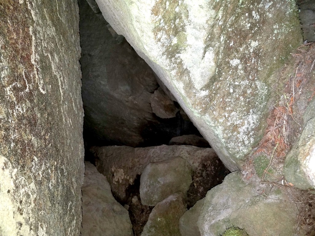
A cave in the gorge between the two mountains created from huge fallen boulders.
In the gorge I found several caves that had formed when huge fallen boulders had crashed upon each other. Some were almost big enough to stand in.
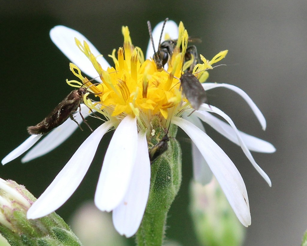
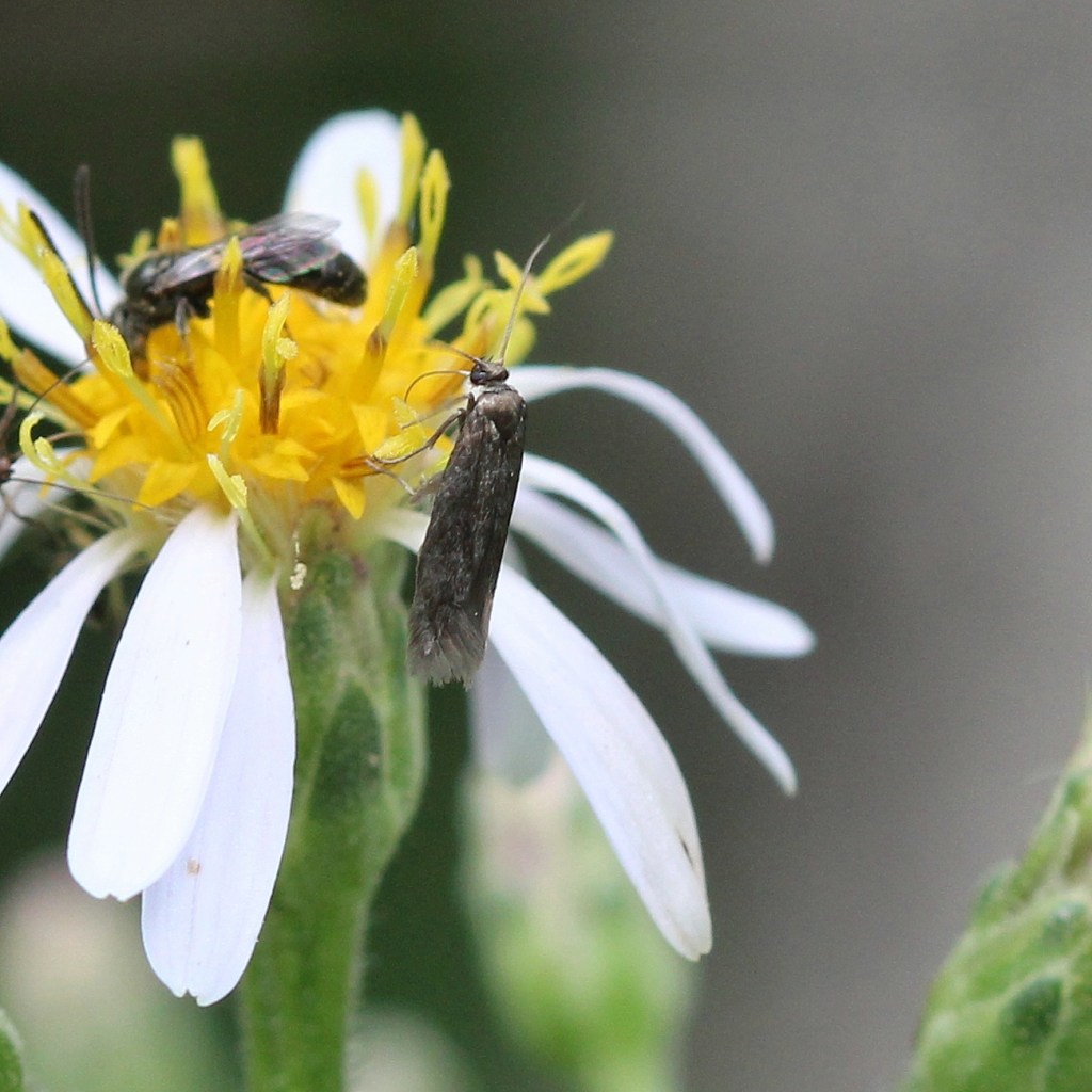
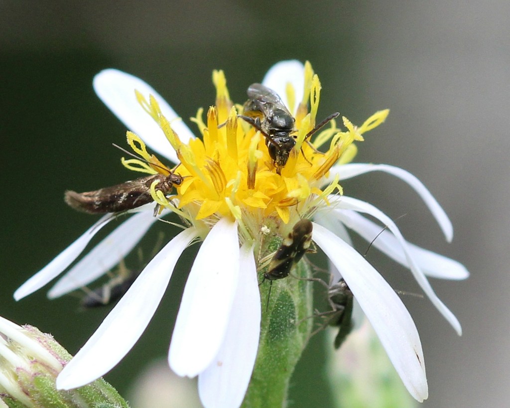
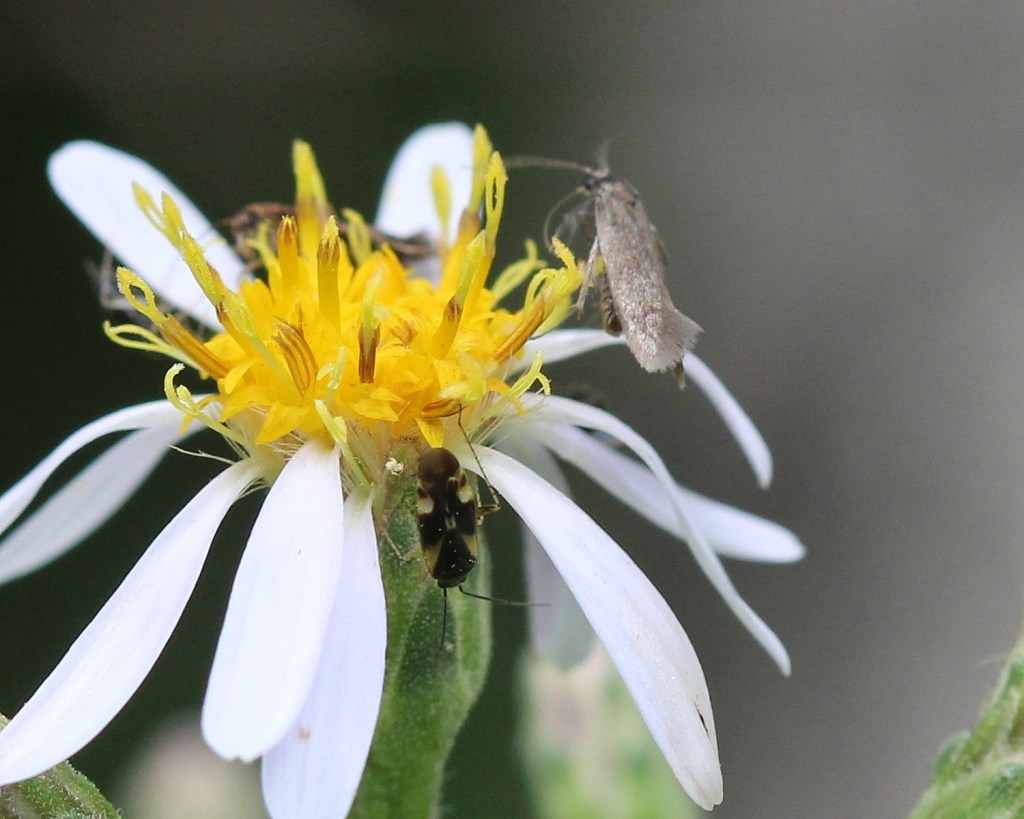
And I found insects, too. All of these were on one big-leaf aster flower. There are two moths (Scythris? and Landryia?), a bug (Plagiognathus obscurus), and a bee (Family Halictidae).
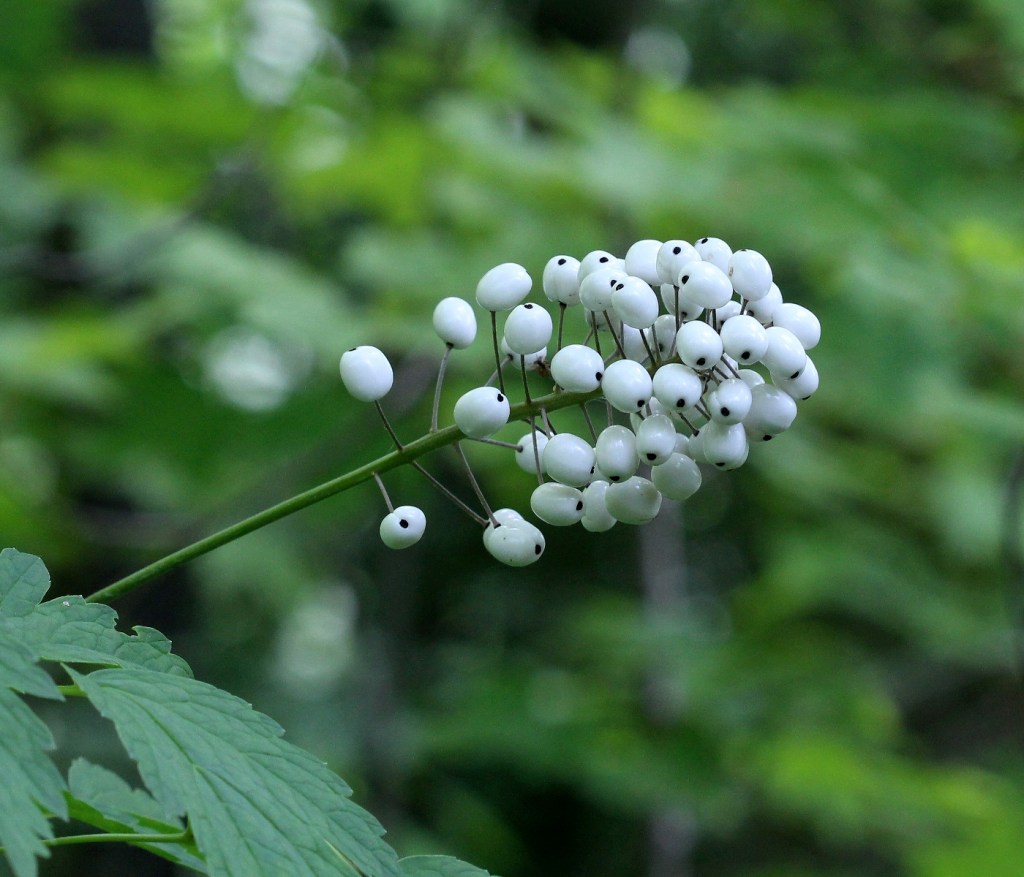
And, finally this plant, Actaea rubra (red baneberry) but with white instead of the usual red berries. It was common along the trail.