Peatlands are beautiful
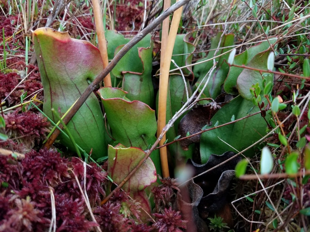
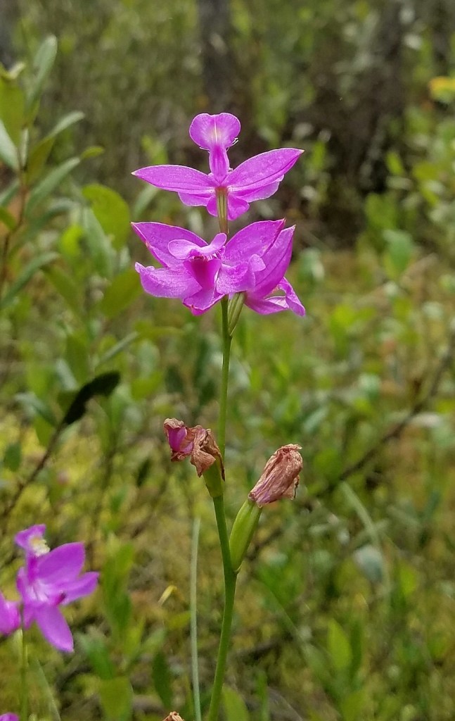
Among my favorite wild places to explore are peatlands, a type of wetland that includes bogs and fens. Peatlands support diverse and unusual plant communities. Many peatlands host uncommon orchids like whorled pogonia, club-spur orchid, grass pink, and dragon’s head orchid. Other unique plants also grow in peatlands, such as sundew, bladderwort, pitcher plant, bog clubmoss, Arctic raspberry, sage willow, yellow-eyed grass, and pale and sooty beak rushes.
Peatland formation
Peatlands typically develop in depressions where soils become waterlogged and lack oxygen, leading to a buildup of dead plant material that exceeds its decomposition. The slow decay of organic matter in the waterlogged soils ties up nutrients, making them less available to living plants.
Peatlands encased in granite
In the Border Lakes Region of Minnesota, peatlands have developed in basins and troughs created by glaciers that scoured the bedrock over thousands of years.
The Border Lakes Region of Minnesota is situated on the 2.7 billion-year-old Vermilion Granitic Complex, described as a “granite-migmatite terrane composed of supracrustal metasedimentary rocks, mafic rocks, tonalitic and granodioritic plutonic rocks, and granite.”
A subdivision of the Vermilion Granitic Complex is the Lac La Croix Granite, which formed “via partial fusion of calc-alkaline tonalitic material, which may have been similar to rocks of the early plutonic suite.”
What might this complex geology and mineralogy have to do with peatlands in that region? The Lac La Croix Granite, as already noted, was derived from partial fusion of calc-alkaline tonalitic material, which is rich in alkaline elements like calcium, potassium, and sodium. My thoughts are that the alkaline mineralogy buffers the pH of the water and peat soils in peatlands. This, in turn, influences the types of vegetation that will grow there and how it will grow.
The hydrology in this region is also complex. The soils are shallow, but the bedrock is deeply fractured. These fractures serve as conduits for subterranean water flow connecting one wetland with another where surface flow is not possible, and supplying dissolved minerals to the wetlands.
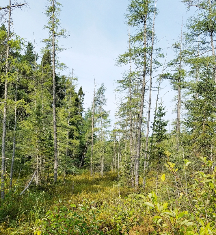
A floating peatland
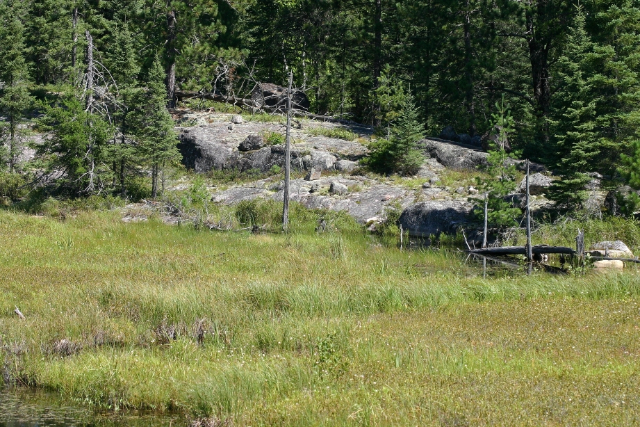
The peatland in the above photo is located in northern St. Louis County, Minnesota, in the heart of the Vermilion Granitic Complex. It is part of a 4-hectare (almost 10 acres) wetland in a 4 km-long (2.5 miles) valley bordered by rock outcrops.
This peatland is a floating vegetation mat composed of peat moss, small sedges, and sundew. It is one of fifteen wetlands in the valley that have developed behind beaver dams.
The valley that contains these wetlands is relatively straight and seems to have been carved from a massive fissure in the bedrock. Some parts of the valley walls are steep cliffs, but most are rounded. Small stones, cobbles, and boulders are often scattered across the outcrops.
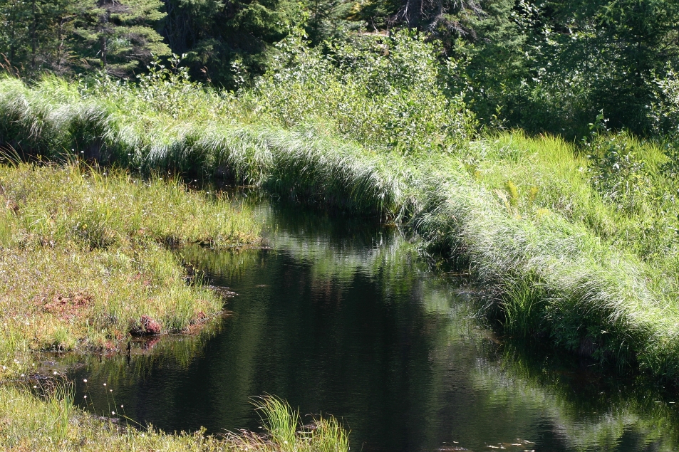
Across the area, there are fissures, large and small, like this one. Many have sluggish streams flowing through them, blocked by beaver dams. Ponds, sedge meadows, marshes, and peatlands have developed behind each dam.
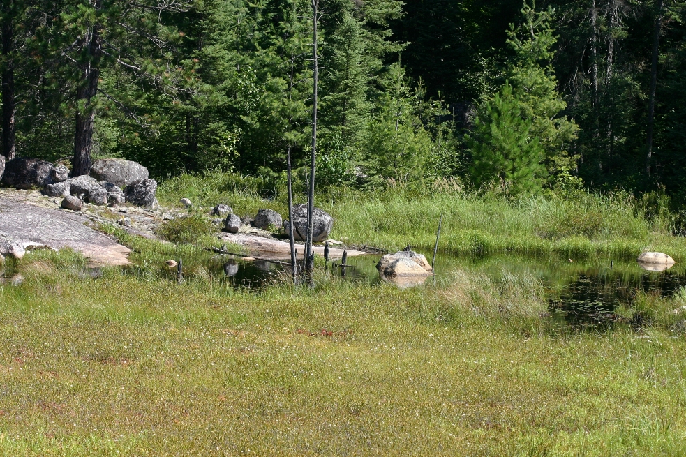
Above is the beaver dam that is holding back the water where the floating vegetation mat has formed. The dam is about 3.6 meters (12 feet) high and 73 meters (240 feet) long. A dense growth of grass and sedge holds it together. A dam this large must be ancient.
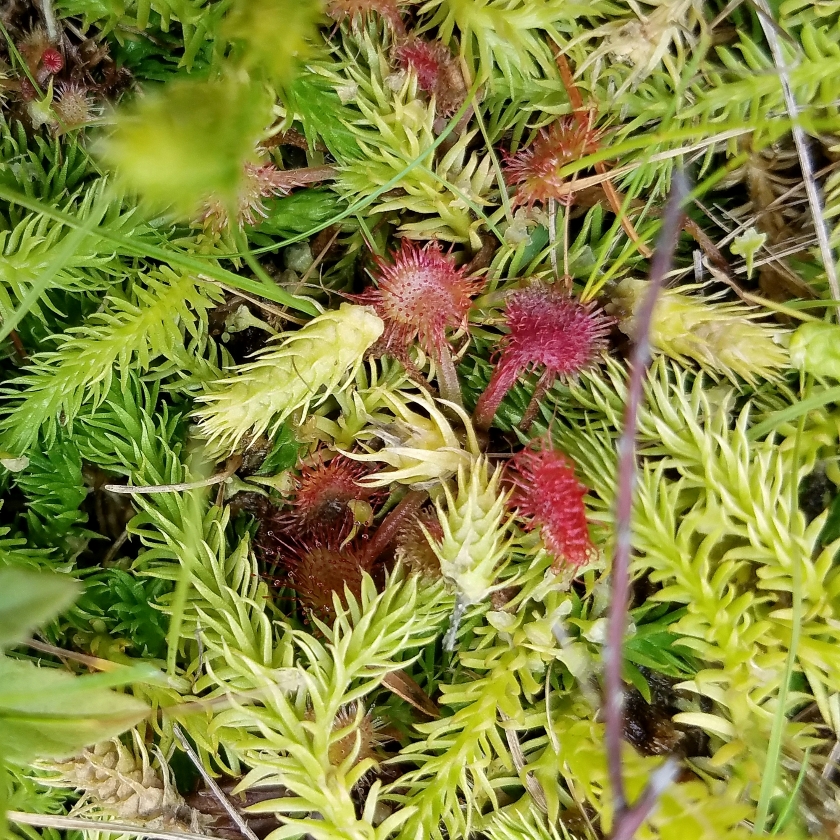
Part of the floating mat is visible in this photo. The reddish areas are sundew plants. Binoculars are helpful in situations like this when walking is not safe.
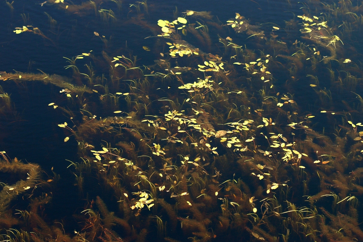
The photo below is from the same pond along the dam where the water is deeper. It is full of pondweeds (Potamogeton spp.) and other aquatic plants like common bladderwort (Utricularia vulgaris). The water’s dark brown color is caused by tannic acids leaching from the peat.
I’m planning to go back
It’s been a few years since I was last at this peatland. Back then, I was doing rare plant surveys in Minnesota and Wisconsin. My schedule was tight, and so I couldn’t spend much time in one place, leisurely exploring.
I have plans to revisit this wetland later this year. I won’t be rushed, trying to keep on schedule like I was when doing rare species surveys. I can take my time exploring these special places, discovering and learning new things about them. This trip will be in small doses over three days. It’s a vacation after all.
The satellite photo below shows the area of interest in the red box. Within that area are not just beaver dams, but upland forests, rock outcrops, and another large peatland that may have been a lake in the distant past.
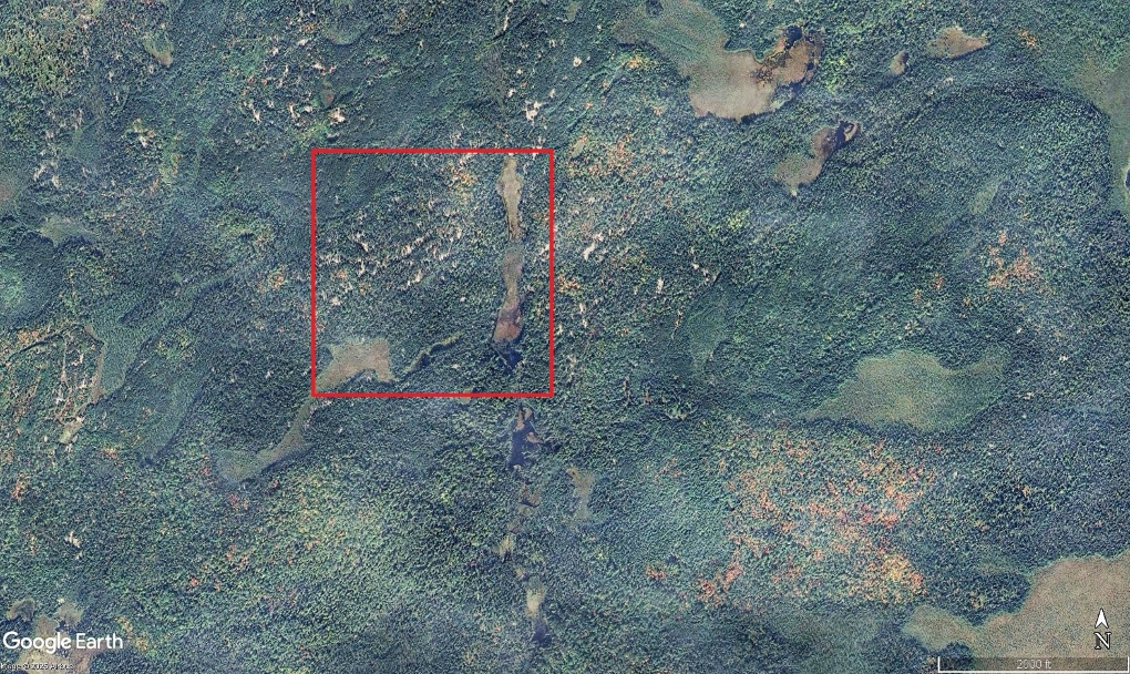
This other peatland is 5.9 hectares (14.5 acres) and is in the lower left corner of the box. It has a large open area with creeping sedge, poor sedge, beaked sedge, white beaked rush, iris, cotton grass, fir clubmoss, bog clubmoss, sundew, and many other plants. I want to spend a long time here wandering around, taking photos, and enjoying the solitude.
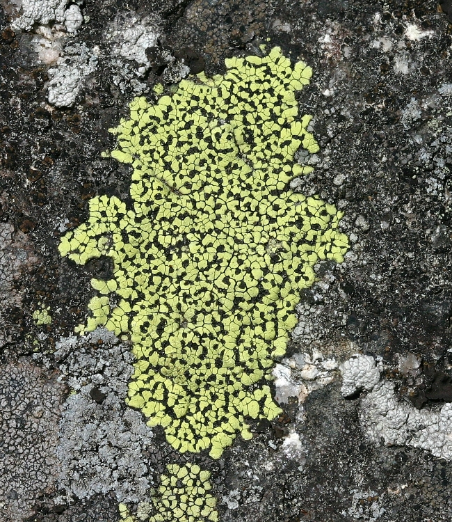
The uplands around the peatlands are forested with white pines and other conifers, paper birch, and red maple. Scattered throughout the forest are many rock outcrops (the light gray areas in the photo map) with colorful, beautifully patterned lichens.
There are peatlands even in the upland forests. These have developed in small basins in the bedrock. The largest is 0.2 hectares (0.5 aces), which is small but similar in size to forest vernal pools. There is no inflow to them or outflow from them, and there was no evidence of upwelling water. I do not know how they remain wet, but they are vegetated with sphagnum, leatherleaf, Labrador tea, pod-grass (Scheuchzeria palustris), and pitcher plants. I wonder how these small peatlands were formed and how they maintain themselves.


